Albuquerque
- For the Portuguese navigator, see Albuquerque, Afonso d'.
Albuquerque (MFA: Albuquerque listen, [ˈælbēˌkɜrkiː]) is a city in the southwest of the United States, the largest city in the state of New Mexico, the administrative center of the district of Bernalillo. The population is estimated at 560,218 in 2018, the 32nd largest city in the United States.
| City | |||||
| Albuquerque | |||||
|---|---|---|---|---|---|
| English Albuquerque | |||||
| | |||||
| |||||
| 35°07' s. 106°37' h.d. | |||||
| Country | USA | ||||
| Mayor | Richard Berry | ||||
| History and geography | |||||
| Founded | 1706 | ||||
| Area | 490.8 km² | ||||
| Center Height | 1619.1 m | ||||
| Climate Type | semiarid | ||||
| Time zone | UTC-7:00, summer UTC-6:00 | ||||
| Population | |||||
| Population | 560,218 people (2018) | ||||
| Density | 1152.38 persons/km² | ||||
| Agglomeration | 1,171,991 persons | ||||
| Katoikonim | albuquerque, albuquerque | ||||
| Digital IDs | |||||
| Phone code | +1 505 | ||||
| Postal Indexes | 87101-87125, 87131, 87151, 87153, 87154, 87158, 87174, 87176 87181, 87184, 87185, 87187, 87190-87199 | ||||
| GNIS | 928679 | ||||
| cabq.gov (English) | |||||
| Media files on Wikimedia Commons | |||||
Etymology
Opinions differ on the origin of the city name. The most common opinion is the name of the city in honor of the Spanish statesman and vice-king of Mexico Francisco Fernández de la Cueva, Count Alburker (1617-1676). The alternative opinion associates the name with the name of Afonso d'Albuquerque (1453—1515), a Portuguese statesman. Both names relate to the name of the Spanish city on the border with Portugal Alburkerke. The very name Alburkerke is denoted as "white oak", from lat. albus (white) and lat. quercus (oak). It is believed that the city is named after the duke of San Felipe de Alburkerque, and the city name in Spain may be derived from the Arabic words "Abu al-Kurk" (cork oak). Subsequently, one of the letters "p" in the title was omitted.
History
The city was founded as a Spanish colonial post in 1706, called Ranchos de Albuquerque, at the time it had 18 families. The Spanish cultural heritage has been preserved in the modern city.
Albuquerque's population was predominantly farming, and the city itself was a military post along the strategic Kamino Real road. Albuquerque also had the status of a center of sheep breeding in the West. The Spaniards had their military garrison in the city since its founding, and later, in 1821, Mexico also stationed a military garrison in Albuquerque. The city was built according to a traditional Spanish scheme: The central square was surrounded by government buildings, town houses and the church.
After the capture of New Mexico by the Americans, in Albuquerque from 1846 to 1867 there was a federal garrison of the US army. During the Civil War, in February 1862, the city was occupied by Confederate forces under the command of General Henry Hopkins Sibley, who soon moved his main units to the north of New Mexico. Then, on April 8, 1862, during his retreat to Texas under the onslaught of the Union's troops, the battle took place against Albuquerque's unit of soldiers under the command of General Edward Canby. In this battle, which lasted all day, the parties suffered small losses, as the troops of the two generals were quite far apart during the battle.
By the beginning of the 20th century Albuquerque quickly turned into a neat city of the southwest of the United States, with a population of 8000 people in 1900. By that time, the city already had all the modern amenities, including the trams that connected the Old and New Town, and the recently established campus of the University of New Mexico. In 1902, the famous Hotel Alvarado was built next to a new passenger depot and remained the symbol of the city until the demolition in 1970.
New Mexico's dry climate contributed to the influx of TB patients seeking treatment in Albuquerque at the beginning of the 20th century.
The first travelers along Route 66 appeared in the city in 1926, and for them soon along the road there appeared many motels, restaurants and souvenir shops.
The establishment of the Curtland Air Force base in 1939 and the Sandia base in early 1940, as well as the laboratories at the base in 1949, made Albuquerque a key player in the Atom Age. Meanwhile, the city continued to grow, with 201,189 inhabitants by 1960. In 1990, the population of Albuquerque reached 384,736, and in 2007 it was 518,271. In June 2007, Albuquerque was ranked sixth among the fastest growing cities in the country, according to CNN and the US Census Bureau.
Due to improvement and renovation programs, Albuquerque, like many US cities, has suffered a decline in development since the 1960s and 1970s, with many historic buildings destroyed to make room for new squares, high-rise buildings and parking spaces as part of the city's renewal phase. Only since 2010, in the center of the city began the restoration of the characteristic image of Albuquerque through the reconstruction and renovation of historical buildings.
Since the beginning of the twenty-first century, the population of Albuquerque has continued to grow rapidly. The population of the city itself was estimated at 528,497 for 2009, compared with 448,607 for the 2000 census. In the agglomeration, the population of Albuquerque has reached 907,775, and the University of Business and Economic Research in New Mexico forecasts that it will increase to 2 million by 2030.
At the beginning of the twenty-first century, the Albuquerque administration made significant efforts to overcome the high crime rate that peaked in the 1990s. According to the FBI, from 1997 to 2012, the city witnessed a decrease in the annual rate of violent crime, while the population was steadily growing.
Geography
According to the US Census Bureau, the total area of Albuquerque is 490.8 km², of which 486.14 km² is land and 4.66 km² (0.95 %) is water.
The Rio Grande River runs north to south through Albuquerque, while the Sandia Mountains are located on the eastern side of the city. The town is located in the far northern part of the Chihuahua desert and has typical climate, flora, fauna and relief for this ecoregion. Located in the central part of New Mexico, Albuquerque has influence over neighboring eco-regions such as the Colorado Plateau, as well as the Arizona and New Mexico mountains.
Albuquerque is one of the largest cities in the United States, located at such a high altitude. The city's height ranges from 1,490 meters above sea level in the Rio Grande Valley, to 1,950 meters in the foothills of the Sandia High and Glenwood Hills. Albuquerque Airport is 1,631 meters above sea level.
The Rio Grande River, which runs through the desert and the city, looks "exotic" and resembles Nile.
Climate
The climate of Albuquerque is classified as desert (in the Köppen-BSk classification), characterized by average annual rainfall of less than half the amount of moisture evaporated during the year, and the absence of months with an average temperature below zero.
The city climate is predominantly sunny and dry, with relatively low humidity and an average of about 3,415 sunny hours per year. There are four distinct seasons in Albuquerque, but the heat and cold are milder than the temperature extremes found in other parts of the country.
The winters in the city are short and quite bright; The average temperature ranges from 7°C to 15°C during the day and about -5°C at night. Nights are usually colder in the valley and foothills by several degrees, and during the passage of cold fronts from the Rocky Mountains and the Great Basin. Snow in Albuquerque is rare and more common in areas with low atmospheric pressure, or when cold fronts pass through the city, but rapidly melts by mid-day, more than half of the meager humidity in the winter comes in the form of rainfall, which is usually very short-lived.
Spring in Albuquerque begins with wind and cool, sometimes with erratic rains and even snow, although spring is usually dry season in the city. In March and April there are quite a lot of windy days, when the wind speed can reach from 32 to 48 km/h, during this period sandstorms and dust storms are common for Albuquerque. But in May, the wind usually subsides, and the weather already resembles summer weather.
In summer, average daytime temperatures typically range from 30°C to 38°C, but at night the temperature often falls to 15°C. Due to low humidity, the heat in Albuquerque is tolerable.
Albuquerque was one of the cities in the region which was hit by heavy snow from 28 to 30 December 2006, during which time it fell to 66 cm of snow.
The average annual precipitation in Albuquerque is only about 215 mm, one of the reasons being the presence of a rain shadow from nearby mountains and plateaux.
- Average annual temperature - +13.9 C°
- Average annual wind speed - 3.6 m/s
- Average annual humidity - 43%
| Climate Albuquerque | |||||||||||||
|---|---|---|---|---|---|---|---|---|---|---|---|---|---|
| Indicator | Jan. | Feb. | March | Apr | May | June | July | Aug | Sep. | Oct. | Noyab. | Dec. | Year |
| Absolute maximum, °C | 22.2 | 26.1 | 29.4 | 31.7 | 36.7 | 41.7 | 40.6 | 38.3 | 37.8 | 32.8 | 28.3 | 22.2 | 41.7 |
| Average maximum, °C | 8.2 | 11.4 | 15.8 | 20.6 | 26.0 | 31.3 | 32.3 | 30.7 | 27.1 | 20.6 | 13.2 | 7.8 | 20.4 |
| Average temperature, °C | 2.4 | 5.2 | 8.9 | 13.3 | 18.7 | 23.8 | 25.7 | 24.6 | 20.7 | 14.2 | 7.2 | 2.4 | 13.9 |
| Medium minimum, °C | -3.3 | -0.9 | 2.1 | 6.1 | 11.4 | 16.4 | 19.1 | 18.4 | 14.4 | 7.8 | 1.2 | -3.1 | 7.5 |
| Absolute minimum, °C | -27.2 | -23.3 | -14.4 | -10.6 | -3.9 | 1.7 | 5.6 | 7.8 | -3.3 | -7.2 | -21.7 | -26.7 | -27.2 |
| Precipitation rate, mm | 10 | 12 | 15 | 16 | 13 | 17 | 38 | 40 | 27 | 26 | 15 | 13 | 242 |
| Source: Weather and climate | |||||||||||||
Population
| Population census | |||
|---|---|---|---|
| Census year | Us. | %± | |
| 1890 | 3785 | — | |
| 1900 | 6238 | 64.8% | |
| 1910 | 11,020 | 76.7% | |
| 1920 | 15,157 | 37.5% | |
| 1930 | 26,570 | 75.3% | |
| 1940 | 35,449 | 33.4% | |
| 1950 | 96,815 | 173.1% | |
| 1960 | 201 189 | 107.8% | |
| 1970 | 244,501 | 21.5% | |
| 1980 | 332,920 | 36.2% | |
| 1990 | 384,736 | 15.6% | |
| 2000 | 448,607 | 16.6% | |
| 2010 | 545,852 | 21.7% | |
| Current 2018 | 560 218 | 2.6% | |
| 1890—2018 * U.S. Decennial Census | |||
According to the 2010 U.S. census, Albuquerque had a population of 545,852, including 239,166 households and 224,330 families. The population density of the city was 1,162.6 people/km².
The racial composition of the population of Albuquerque was as follows:
- Hispanics - 46.7%,
- white - 42.1%
- African Americans - 3.3%
- Indians - 4.5%,
- Asians - 3.2%,
- Hawaiians - 0.11%,
- persons of other races - 15.03%
- persons of two or more races - 4.6%
Age structure of the city population: up to 18 years — 24.5%, 18-24 years — 10.6%, 25-44 years — 30.9%, 45-64 years — 21.9% and 12.0% — 65 years and over. The average age of the Albuquerque population was 35. For every 100 women there were 94.4 men. For every 100 women aged 18 and over, there were 91.8 men.
The average annual household income in the city was 38,272, and the average household income was $46,979. The average income of men is 34,208 compared to 26,397 dollars in women. Per capita income in the city as of the census date was 20,884 dollars. About 10.0% of households and 13.5% of the total population lived below the subsistence level, of which 17.4% were under the age of 18, and 8.5% were aged 65 or over older.
Economics
| The largest employers in Albuquerque (estimate) | |
|---|---|
| 3 | Kirtland airbase |
| 2 | University of New Mexico |
| 3 | Sandia National Laboratories |
| 4 | Public schools in Albuquerque |
| 5 | Presbyterian Health Service |
| 6 | Albuquerque Administration |
| 7 | Lovelace-Sandia Health System) |
| 8 | Presbyterian Medical Services (Presbyterian Medical Services) |
| 9 | Intel Corporation |
| 10 | Government of New Mexico |
| 11 | Walmart |
The modern Albuquerque is located in the center of the New Mexico Technology Corridor, which unites a significant number of high-tech private and government companies and organizations located along the Rio Grande. Historically, after WW2, Albuquerque's largest organizations are linked to the creation, development, and maintenance of the U.S. nuclear weapons arsenal. The largest employer in Albuquerque, Kirtland Airbase (an estimated 15,000 civilian and military workers) is America's main nuclear arsenal. Kirtland Air Base, Sandia National Laboratories and numerous subcontracting organizations are creating a strong demand for highly skilled personnel in the region.
Intel has set up several major factories (Fab 11 in 1995, Fab 11X in 2005) and Research Center (Fab 9 with Fab 11 in 1999) in the suburbs of Albuquerque Rio Rancho to produce half-wire nikov. The corporation in Albuquerque was attracted by a good business climate and the availability of qualified personnel. The technologies used at these plants are gradually becoming obsolete, but the corporation is considering the prospects of creating new production facilities (Fab 21) in Albuquerque.
In Albuquerque is located one of the divisions of the corporation Northrop Grumman, a large plant for the production of bedding of the company Tempur-Pedic. In 2009, the production of solar energy converters of the international concern SHOTT AG started, but due to market fluctuations in 2012 the production activities stopped.
In 2006, Forbes magazine named Albuquerque the best city in the United States for business and career, and in 2008 it ranked it 13th among 200 cities. In 2014, Forbes placed Albuquerque in 7th place in the list of the best cities for engineers in the USA. In 2009 Albuquerque was included in the top ten cities of the USA for life according to U.S. News & World Report, and according to TLC, the network was put in 4 place according to the living conditions for families.
The city was included in the list of the best cities for work in 2007 and in the top 50 best places for life and work according to the magazine National Geographic Adventure.
Infrastructure
Transport
Main highways
Some of Albuquerque's main highways:
- I-25 (Interstate 25). The city is called the Pan-American Highway, of which the main line is part. It serves as one of the main routes of north-south communication on the left, east bank of the Rio Grande. The I-25 is also the main north-south route between Albuquerque and Santa Fe and Las Cruces in New Mexico. As of 2019, I-25 coincides with the only US 85 federal motorway in Albuquerque, which in the state of New Mexico is not marked with road signs.
- I-40 (Interstate 40). The city is called Coronado Freeway. This name is associated with the name of the conquistador of the 16th century Francisco Vázquez de Coronado. It serves as one of the main routes of the east-west direction, crosses the Rio Grande on a bridge built in 1964.
- Paseo del Norte (Paseo del Norte). The street all over the length coincides with the highway NM 423 New Mexico. Most have 6 lanes, some areas are four-lanes. All intersections with other roads are regulated. The main direction is east-west, located about 5 miles (8 km) north of the I-40 highway. Beginning at the crossroads with Tramway Blvd, at the foot of the Sandia Mountains, I-25 crosses the three-level intersection. Then it passes through the village of Los Ranchos de Albuquerque, and then through the bridge across the Rio Grande to the Boulevard of North Coors Boulevard). Then Paseo del Norte passes through the Petroglif monument before crossing with Boulevard Atrisco Vista Blvd at the Dable Eagle II Airport. The Passage of Paseo del Norte with the I-25 was reconstructed in 2014 to improve traffic conditions.
- Bulvar Kears — the main north-south route of the western Albuquerque on the right bank of the Rio Grande. The only fully fledged interchange is built at the intersection with I-40, the other large intersections are regulated by light-trackers. Boulevard Curse and I-25 intersect at different levels on the southern outskirts of Albuquerque, but have no reciprocal entry and exit. The small northernmost area of Curse matches the state road NM 448, and almost all of the rest is the same NM 45. Part of the street is equipped with pavements, bicycle paths and high-quality markings, but there are areas with dirty wallpaper and unregulated intersections.
- Rio Bravo Boulevard (Rio Bravo Boulevard). The main road linking the south-western part of Albuquerque to the south-eastern part, with the area of Sanport International Airport. The four-lane University Boulevard, with a direction separator, runs from Boulevard to Boulevard Kurs, where the highway is called the Boulevard of Dennis Chávez ( Dennis Chaves Blvd). Almost all the way from Boulevard Curse to the intersection with I-25 coincides with the state road NM 500.
- Central Avenue Central Avenue, one of the parts of the historic US 66 highway, was removed from the motorway in 1980 and replaced by modern highways, primarily the I-40.
- Bulvar Alamida Alameda Boulevard is the main road linking Rio Rancho and the northeastern part of Albuquerque. It starts from Ventura Street and ends at the intersection with Boulevard Curse. The section from Sekond Street to Curse matches the state highway NM 528.
- Bulvar Tramway Tramway Boulevard, the most eastern highway in Albuquerque north-south, runs along the foothills of the Sandia Mountains and serves as the bypass of the north-eastern part of Albuquerque. Same as the state NM 556. Starting from intersection with I-25 in the Sandia Pueblo area And he went east; near the lower station of the Sandia Pick Trumway" turns south to the intersection with I-40 and Central Avenue in the area of Canyon Tijeras.
Intersection I-25 and I-40 are known as "Big Ai" It was built in 1966, in 2002 the capital reconstruction was completed. This is the only five-level solution in the state of New Mexico.
Bridges
Six municipal bridges cross the Rio Grande River in Albuquerque. Nord to south (or downstream of the Rio Grande):
- Alameda Bridge)
- Paseo del Norte Bridge (Paseo del Norte Bridge)
- Montaño Bridge (Montaño Bridge)
- Ai-40 Bridge (English I-40 Bridge)
- Central at Old Town Bridge (Central at Old Town Bridge)
- Barilas Bridge (Barelas Bridge)
At the first three bridges, the eastern entrances are not on the city's territory, but on the territory of the villages of Los Ranchos de Albuquerque and North Valley, which prevents the expansion of the transport flow due to the opposition of the local population.
Two other bridges, which are important for organizing traffic in the urban agglomeration, are located in the southern urban area:
- Rio Bravo Bridge (Rio Bravo Bridge)
- Ai-25 Bridge (near Islet Pueblo) (I-25 Bridge)).
Railways

Most of Albuquerque's railway network belongs to the state of New Mexico. The network is used for commuter, long-distance and freight traffic.
Freight
Freight rail transportation is carried out by BNSF Railway Company, a small cargo terminal located in the southern part of Albuquerque south of Caesar E. Chávez's Avenue and near the Depot of Rail-Ranner Express. The main cargo traffic in central New Mexico goes through a larger terminal near the city of Belén.
Passenger service
The only long-distance train route through Albuquerque is the Southwest Chif of Amtrac Corporation from Chicago to Los Angeles. It runs through Albuquerque daily in both directions and has one stop at the Alvarado Transportation Center in downtown Albuquerque.
Suburban message
In 2006, the Reil-Ranner Express commuter between Albuquerque and Sandoval began using the rights to organize traffic acquired in 2005 by the State of New Mexico from the BNSF Railway. In 2006, the service was extended to Valencia County and in December 2008 to Santa Fe. As of 2019, the Rail-Runner Express has 19 stops, including three stops in Albuquerque, and connects the districts of Santa Fe, Bernallo, Sandoval and Valencia. The line runs eight weekdays between Albuquerque and downtown Santa Fe. Traffic to the town of Belen is less frequent.
Public transport
Albuquerque was one of the two cities in New Mexico that had tram public transport (second Las Vegas). Since about 1880 on a horse traction, and by 1904 - on electric. The system has been operated by Albuquerque Traction Company since 1905. In the following ten years, the lines have grown to 6 miles (9.7 km), which have connected the city center of the former Atchison, Topeca and Santa Fe Reilui railway depot with the old town in the west and the University of New Mexico in the east. Albuquerque Traction Company was founded in 1915 and the City Electric Company was established to manage the tram economy. Despite the revival of transportation during the First World War and the won legal claims of the authorities trying to force the company to pay for the roads, the company also collapsed in 1927 and the Albuquerque tram stopped working.
Modern urban transport is managed by municipal system "DAP RIDE"", the largest in the state of New Mexico. The system includes regular bus service on several dozens of different routes, as well as rapid Ride express".
In 2006, the administration of Mayor Martin Chávez planned and attempted to launch a US$270 million modern tram "Modern Streetcar", but it was not implemented due to the open opposition of many city dwellers. However, the city authorities and the city transport department continue their policy of supporting the establishment of tram services. The project involves the creation of tram lines mainly in the south-eastern part of the city on Central Avenue and the Yale Boulevard.
Since 2011, city authorities have been working to create a system of express buses Central Avenue. This route carries approximately 44% of all the passengers on the DAP RIDE, which is the best route for efforts to improve urban transport.
In 2017, the Reorganization of Express Transport (ART) began, which includes the organization of allocated public transport lanes between Boulevard Curse and Boulevard Louisiana.
Bike infrastructure
The city has a well-developed cycling network. As of 2019, the length of individual cycle routes, allocated lanes and bicycle routes is more than 400 miles. In 2009, Albuquerque was marked as a city with an existing and developing system for cyclists. This year, the city opened its first bicycle boulevard on Silver Avenue. Its length is 7.5 miles (12 km). The city plans to continue investing in bicycle transport in the city, including credit programs.
Opportunities for pedestrians
In 2011 Walk Score In its study of pedestrian conditions in the 50 largest cities in the United States, Albuquerque ranked 28th.
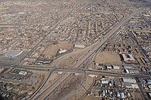
Airports
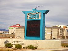
Albuquerque is served by two airports. Large Sanport International Airport is located 3 miles (4.8 km) southeast of the Albuquerque business center. In 2009, it served almost 5.9 million passengers.
Second airport Dable Eagle II much less. It is used mainly for air medicine, business flights, military, training, charter and private flights.
Utilities
Electricity
PNM Resources is the largest supplier of electricity in Albuquerque Inc., a public service company. As of 2019, it serves approximately 781,000 households and companies in the northern state of New Mexico and western Texas.
Gas supply
New Mexico Gas Company, founded in 2009, provides the main supply of natural gas. As of 2019, it serves approximately 524,000 consumers.
Water supply and sanitation
Albuquerque Bernalillo County Water Utility Authority, founded in 2004, provides drinking water and water disposal services in Albuquerque. The company is run by a Board of three representatives from Albuquerque and Bernallo County, the mayor of Albuquerque, and the representative of the village of Rio Rancho (the latter without the right to vote).
Garbage and secondary resources
The City of Albuquerque Solid Waste Management Department handles secondary resources and waste. There are 16 waste disposal sites in the city. There are city-wide programs to remove graffiti, weeds and street debris.
Health
Albuquerque is the state's main health and health care center with many modern services. Largest: VA Medical Center, Presvitarianism Hospital, Presbyterian Medical Service, New Mexico State Heart Hospital of New Mexico, Lovel Women's Hospital Lovelace Women's Hospital. University of New Mexico Hospital — the main training center for state medical schools, it also includes a children's hospital, a burnt-out center, a pediatric center and trauma at the highest, 1st level of competence. The University Hospital has a wide range of specialists and serves as a certified diagnostic center.
Interesting facts
- In 1935-1936, two Soviet journalists and writer Ilya Ilf and Evgeny Petrov made a car trip around the United States and wrote a popular book, "One-story America." Despite the desert climate and very rare precipitation in Albuquerque, the travelers came to the city during the rain and managed to find the first puddle in the journey in which their car was stuck.
We were leaving Albuquerque in a terrible morning. Beautiful mud houses with exposed ends of ceiling beams, Coca-Cola posters, monasteries, pharmacies, ancient Spanish missions and the same as in the East, gasoline stations all were flooded gray rain water. Here at the entrance to the houses there were wooden yards from wolfing bows (memory of the pioneers-gold detectors). The roofs of Mexican hats dried, or rather, the moths, bundles of red pepper. Mokley offers excursions to nearby Indian villages and Spanish missions
— I. Ilf, E. Petrov. One-story America. 1937.
- Most of the events in America's popular TV series "Breaking Bad" (and the spinoff "Call Sola Better") take place in Albuquerque. Most of the filming of the series was also carried out in Albuquerque and the surrounding area.
- For the first time, the idea of bringing advances in telecommunications technology, such as electronic bracelets, into the service of delinquent control came to the attention of US judge Jack Law of Albuquerque after reading a popular comic book about Spiderman.
Attractions
- Petroglif National Monument
- National Laboratory for the Study of Solar Thermal Energy
Twin cities
- Spain : Alburkerke, Gijon
- Turkmenistan : Ashgabat
- Mexico : Guadalajara, Chihuahua
- China : Lanzhou
- Japan : Sasebo
- Germany : Helmstedt
- Republic of China : Hualyan
See also
- List of the highest buildings in Albuquerque
Notes
- ↑ When calculating population density, only the land area of the city was used 486.14 km².
- ↑ Gorodetskaya I. L., Levashov E. A. Albuquerque // Russian names of residents: Dictionary-directory. — M.: ACT, 2003. P. 26. 363 p. — 5000 ex. — ISBN 5-17-016914-0.
- ↑ Metropolitan and Micropolitan Statistical Areas (unavailable link). Case date: May 23, 2013. Archived March 17, 2013.
- ↑ Metropolitan and Micropolitan Statistical Areas Totals: Vintage 2011 - U.S Census Bureau (not available link). Census.gov. Case date: June 27, 2013. Archived May 5, 2013.
- ↑ Douglas Harper's Etymological Dictionary
- ↑ Have you ever wondered about Albuquerque’s "R"? (English)
- ↑ List of Arabic and Spanish names for Iberian cities and places أسماء ال.
- ↑ http://www.nmallstar.com/albuquerque_visitor_information.html#Albuquerques Backup from March 25, 2012 on Wayback Machine History
- ↑ Les Christie. The fastest growing U.S. cities. CNNMoney (June 28, 2007). Case date: March 28, 2013. Archived April 4, 2013.
- ↑ Siermers, Erick Managing Albuquerque's growth (September 17, 2007). Case date: September 17, 2007. Archived February 22, 2010.
- ↑ FBI: Uniform Crime Reporting Statisctics
- ↑ Climatological Normals of Albuquerque. Hong Kong Observatory. Case date: May 13, 2010. Archived February 16, 2012.
- ↑ NCDC: U.S. Climate Normals (PDF). Case date: October 31, 2010. Archived February 16, 2012.
- ↑ Preliminary total snowfall reports across central and northern New Mexico from the December 28-30 winter storm (not available link). National Weather Service Albuquerque, NM (December 31, 2006). Case date: August 5, 2009. Archived February 16, 2012.
- ↑ American FactFinder
- ↑ Robinson-Avila, Kevin. Schott Solar Mesa del Sol Plant To Shut, Albuquerque Journal.
- ↑ Best Places For Business And Careers 2006, Forbes (January 1, 2006). Date of appeal 20 January 2009.
- ↑ Best Places For Business And Careers, Forbes (March 19, 2008). Archived January 22, 2009. Date of appeal December 23, 2008.
- ↑ America's Engineering Capitals: No. 7, Albuquerque, NM.
- ↑ Best Places to Live 2009.
- ↑ Top 10 Cities for Families.
- ↑ Kurdahy, Matthew. Top 10 Cities for Jobs (October 12, 2007).
- ↑ Koeppel, Dan. Best Places to Live + Play: Cities (September 2007). Archived April 16, 2008.
- ↑ 1 2 3 4 Bryan, Howard. Albuquerque Remembered. — Albuquerque: University of New Mexico Press , 1989. — ISBN 0-8263-3782-1.
- ↑ Archived copy. Case date: October 12, 2017. Archived October 13, 2017. Paseo del Norte at I-25 Interchange Reconstruction Project - City of Albuquerque
- ↑ New Mexico Rail Runner Express: Stations listed North to South available). New Mexico Rail Runner. Case date: August 2, 2009. Archived January 6, 2012.
- ↑ New Mexico Rail Runner Express Monday-Friday Schedule (PDF). New Mexico Rail Runner Express (December 2, 2008). Case date: December 23, 2008. Archived January 14, 2009.
- ↑ Myrick, David F.,. New Mexico's Railroads — An Historical Survey. — Golden, Colorado: Colorado Railroad Museum, 1970.
- ↑ Gisick, Michael. Council: Streetcar project rushed (December 4, 2006). Archived October 4, 2010. Date of appeal April 26, 2009.
- ↑ Planning for the Future: Bus Rapid Transit (BRT) Service on Central Avenue. CABQ.gov. Case date: October 5, 2011. Archived October 11, 2011.
- ↑ Albuquerque Rapid Transit. Case date: December 22, 2018.
- ↑ Biking in Albuquerque. City of Albuquerque. Archived December 22, 2008.
- ↑ Information about biking in Albuquerque..
- ↑ Smillie, Eric Sorry, Portland (April 27, 2009). Case date: August 5, 2009. Archived June 26, 2009.
- ↑ Jeremy Jojola, Joshua Panas. Bike Boulevard to run through DAP. KOB New Mexico (January 14, 2009). Case date: August 5, 2009.
- ↑ Bicycle Boulevard In Brief. (Unavailable link)
- ↑ Albuquerque To Launch Bike-Sharing Program.
- ↑ 2011 City and Neighborhood Rankings. Walk Score. Case date: August 28, 2011.
- ↑ Sunport Facts & Figures. City of Albuquerque. Case date: February 12, 2009. Archived February 13, 2009.
- ↑ Double Eagle II Airport. City of Albuquerque. Case date: February 12, 2009. Archived February 3, 2009.
- ↑ PNM Resources.
- ↑ Facebook. New Mexico Gas Company.
- ↑ The Albuquerque Bernalillo County Water Utility Authority.
- ↑ Recycling Drop-off Sites.
- ↑ Where they filmed "Breaking Bad". www.gq.ru. Case date: February 16, 2018.
- ↑ "Take a bracelet, go home" "Rossiyskaya Gazeta" - Week No. 0(4290) of 09.02.2007.
- ↑ "To the question of foreign practice of the application of the system of electronic monitoring of controlled persons", Journal "The Bulletin of the Institute" No. 28, 2014, VIPE FSIN RF.
Links
- Official Website
- Business and tourist information
- Albuquerque Large Chamber of Commerce and Industry
- Photos and information for guests of the city